
Figure 6
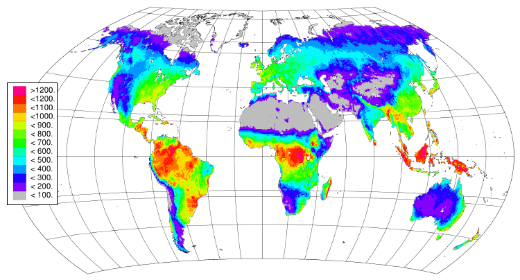
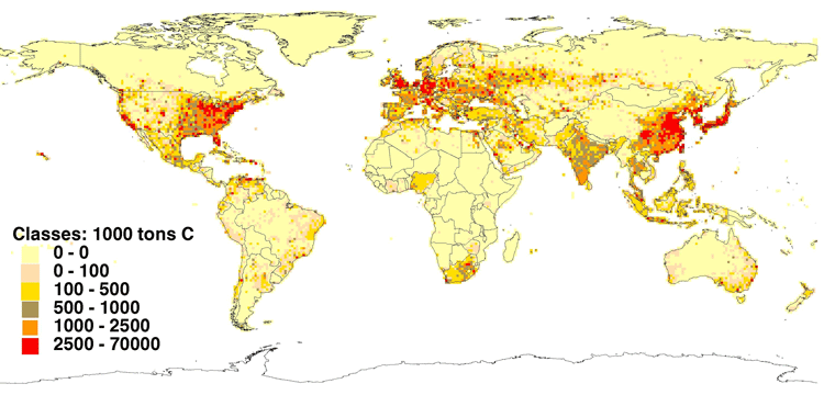
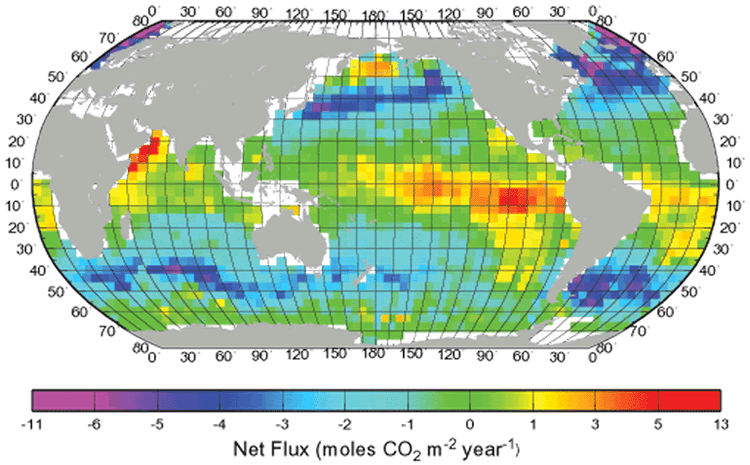
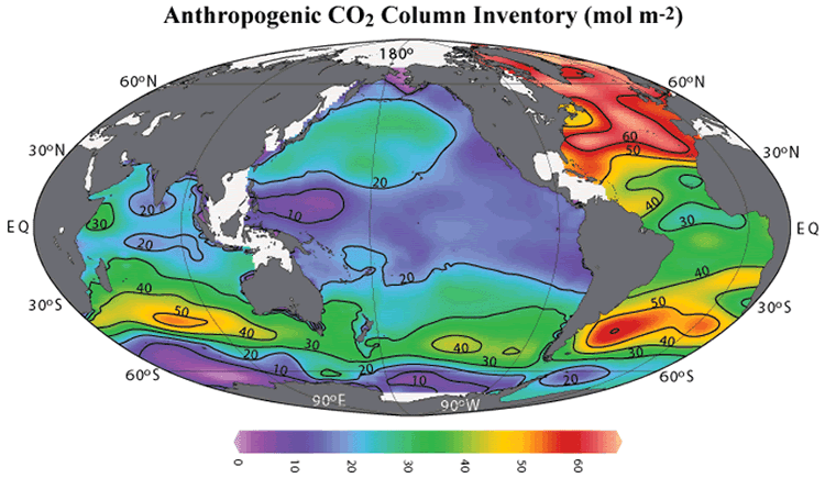
Figure 6. Spatial observations critical to determining patterns and variability in the stocks and fluxes making up the carbon cycle. (a) Global map of terrestrial net primary production (NPP) from the IGBP Potsdam NPP Model Intercomparison, gC m-2 (Cramer et al 2001); (b) 1995 carbon dioxide emissions from fossil-fuel burning, cement production, and gas flaring at one degree grid basis emissions (Brenkert 1998 [http://cdiac.esd.ornl.gov/], map prepared by R J Olson, Oak Ridge National Laboratory, Oak Ridge, Tennessee, United States); (c) Mean annual net-air sea flux for CO2 (mole CO2 m2 yr1) for 1995 (Takahashi et al 2002); and (d) Anthropogenic CO2 column inventory (mol m-2) (Sabine et al 2003).